Author: kevin

  • 2017-05-16 Dumped UK distress beacon sparks major sea search in Cornwall

    It has emerged that a distress beacon that sparked a huge search off the Cornish coast in the UK was later found dumped in a bin.

    “This was an extremely irresponsible thing to do which resulted in the unnecessary launch of two RNLI lifeboats – extreme care & caution should always be taken when disposing of an active EPIRB”.

    Read more here:
    https://www.piratefm.co.uk/news/latest-news/2289392/dumped-distress-beacon-sparks-major-sea-search/ 

  • 2017-05-05 Local Italian high school visits Cospas-Sarsat Satellite Station in Bari

    Local high school students from near Bari were able to peer into the world of search and rescue by touring some of the Cospas-Sarsat satellite station.

    They learned how an alert progresses, and about the new functionality being developed with MEOSAR and the Return Link Service.

    Read more here:
    http://www.molfetta.ilfatto.net/index.php/cultura/9067-molfetta-il-liceo-classico-in-visita-alla-stazione-satellitare-cospas-sarsat 

    Translation:

    Molfetta. Discovering the great things happening in our community is an opportunity and a privilege, especially when they are located in Puglia and representing them is someone from Puglia.

    We are talking about Bari’s International Cospas-Sarsat Satellite Search and Rescue Station, headed by Frigate Captain Pantaleo Dell ‘Olio, originally from Bisceglie.

    Classes II A and II B of Molfetta High School visited the International Cospas-Sarsat Satellite Station for search and rescue in Bari.

    Cospas-Sarsat is a search and rescue programme that uses satellite technologies to locate endangered beacon carriers on land, sea and air. Italy, with the Ministry of Civil Protection, has committed itself to the spreading of alert messages to all nations. The visit was multidisciplinary: international jurisprudence, English language, biology, ecology, environment, Earth sciences, mathematics and physics.

    It is certainly more interesting to replace a book lesson with a live one, listening to the active voices of the protagonists at their tasks and activities.

    “The Cospas-Sarsat station, whose name derives from the use of Russian and American satellites respectively”, explains Commander Dell’Olio, “deals with naval, terrestrial and airborne sea and naval defense in case of search and rescue and terrorist attacks in areas without coverage or as a result of sudden events that have prevented the sending of alarm signals. The station was activated in Italy in 1966 and entrusted to the body of the Coast Guard after the Memorandum of Understanding of Canada, France, the Soviet Union and the United States was signed in 1979: it is the only one in Italy and covers an area of responsibility that includes 20 countries. The system serves PLB, EPIRB and ELT beacon users, space (satellite) and ground (station) segments. The System is undergoing evolution: the Galileo system will allow 75 satellites to cover the area of responsibility every minute and the new beacons will allow feedback, i.e., the user will know if his alert has been transmitted.”

    Rapid intervention of SAR teams increases the survival rate of the people involved, and the location of an accident reduces both the costs of operations and the risks to which the teams involved in search and rescue operations are exposed.

    The Italian Cospas-Sarsat Satellite Station is located in Bari and has been operational since 1 June 1996 with DPCM 9 May 1996. It operates 24 hours a day For 365 days a year and is equipped with two dedicated antennas, one for the LEOSAR system and one for the GEOSAR system. The Satellite Station is able to receive and locate emergency signal transmitters (EPIRB-ELT-PLB) that transmit on the 406 MHz digital frequency.

    The students visited the Command Center, where it was possible to observe practically how an alert progresses, its verification, and the possible activation of rescue operations.

    The students were accompanied by Professors Bianca Maizza and Giovanna Saltarelli.

    Surely the kids will remember this experience because they have had direct experience of both the site and the commander, ready to satisfy their curiosity and answer their questions.
  • 2017-05-03 Galileo Cospas-Sarsat SAR service launched on 406 Day in Europe

    A representative of the EC moderated the SAR session discussing this product of a “long-lasting collaboration with Cospas-Sarsat”, which is the only system that can independently locate a distress beacon wherever it is on Earth.

    “Galileo will be the first full constellation with global SAR capability,” said the Head of the Cospas-Sarsat Secretariat.

    “This new MEOSAR system has a larger footprint than the current low-earth orbit (LEO) system.”

    It also provided improved location accuracy, and the return link available on the Galileo implementation allowed a reassuring response to be sent to the person who had activated the beacon.

    Read more here:
    https://www.gsa.europa.eu/newsroom/news/galileo-search-and-rescue-service-ready-green-light 

  • 2017-04-26 2017 Task Group Meeting on SGB and SGB/FGB ELT(DT) Technical Documents

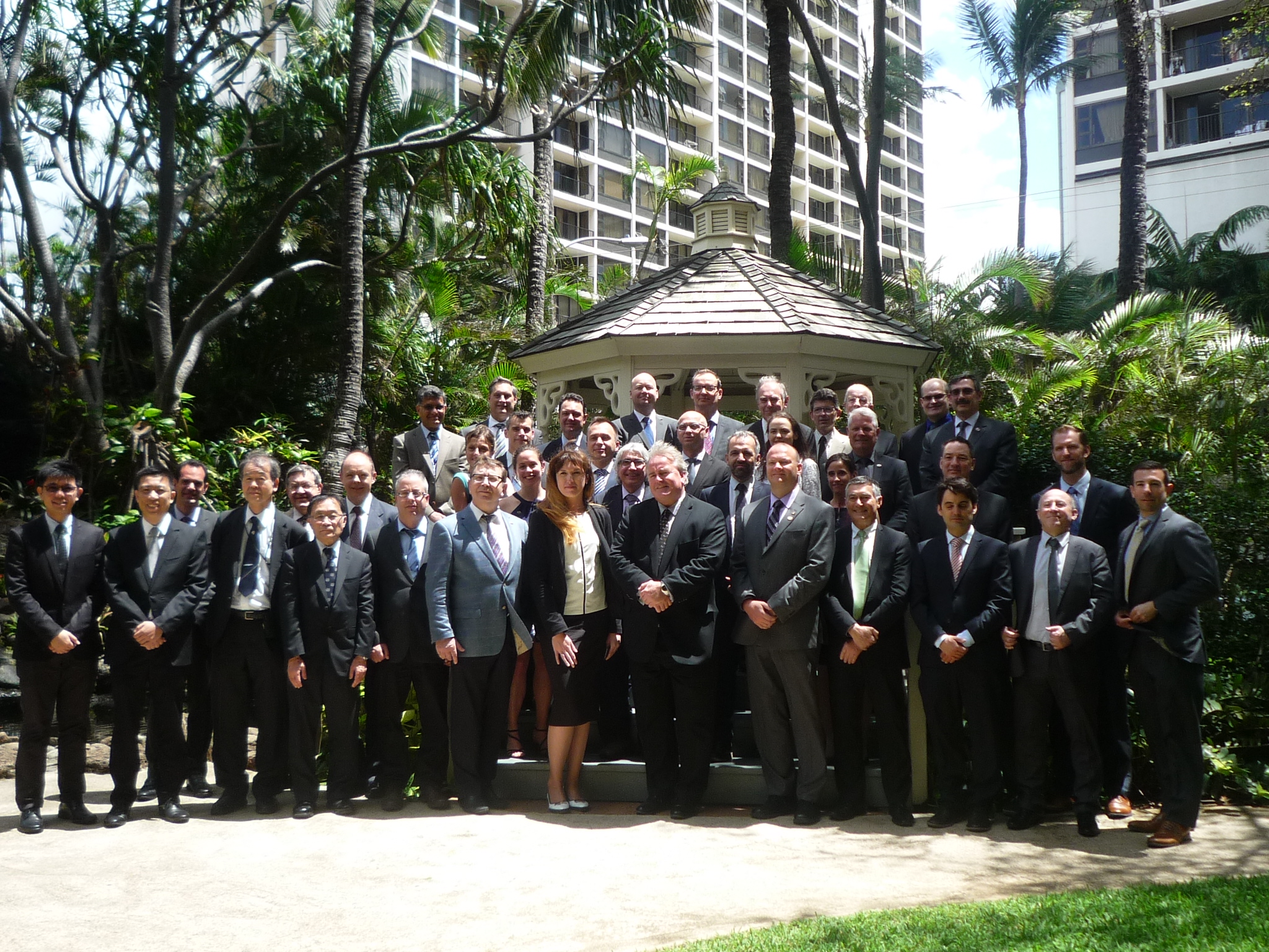
    The 2017 Task Group Meeting on Second-Generation Beacons (SGB) and SGB/FGB ELT(DT) Development Of Technical Documents was held in Honolulu, USA from 28 March to 3 April 2017. Mr. Anthony Foster (USA) chaired the meeting.

    39 people, including members of nine Cospas-Sarsat Participants, one Observer Organization and the Secretariat took part in the meeting.

    Photo

  • 2017-04-26 FACh joins MEOSAR system that allows to instantly locate ships or aircraft in emergency

    English version below. Spanish-language article here: FACh se une a sistema que permite localizar al instante barcos o aviones en emergencia

    Article photos: http://impresa.elmercurio.com/MerMobileIphone//Pages/NewsDetailMobile.aspx?dt=2017-04-24&BodyId=3&PaginaID=1&SupplementId=0


    FACh joins a system that allows to instantly locate ships or aircraft in emergency

    Posted on April 24th, 2017

    Chilean Air Force (FACh), specializing in this type of situation, will join a new procedure that works with medium-orbit satellites, more responsive to alerts.

    (El Mercurio) Passengers on a crashed plane have a 60% chance of surviving if the rescue takes place within the first eight hours; Explains Colonel Aviation Eleazar Bravo, head of the Department of Planning and Development of the Air Search and Rescue Service of the FACh (SAR).

    Every minute is key. For this reason, Chile has decided to join a new system, which operates with 75 satellites to locate emergency signals emitted by beacons located, for example, in airplanes and ships.

    The big difference with the current method is that today the FACh receives information captured by five satellites of low polar orbit (Leosar) and one geostationary (Geosar).

    The data of these arrive at the antennas installed in Punta Arenas (Magallanes and Chilean Antarctica region), Easter Island (administratively belongs to the region of Valparaíso) and Cerrillos (Metropolitan region). The estimated time in which the location of a damaged ship can be captured is between 5 and 8 minutes.

    Greater Accuracy

    The new system, called MEOSAR, works with a network of medium-orbit satellites that are able to capture the location of a beacon almost immediately and with greater precision, obtaining the exact point of an accident or the area where an aircraft was lost .

    This improvement, which will cost US $ 5 million and will be operational in 2019, will allow the Chile Mission Control Center – 24 hours a day at Cerrillos Air Base – to give notice of the situation more quickly, obtaining valuable minutes to respond to a potential emergency.

    Functioning

    To fly with the appropriate authorization, all aircraft, whether private or commercial, must have a small device called the Emergency Locator Transmitter (ELT). During the flight it goes off, but if an impact is registered or the pilot decides to activate it, it emits signals that are captured by the satellites, and that allow the Air Search and Rescue Service to take action.

    However, the ELT also has its limitations: it can not emit signals if it is submerged in water, and if the impact is too strong, it can be destroyed.

    Another thing that can happen with the current satellites that inform Chile is that the signal that reaches to send the device is too short to be collected. MEOSAR, on the other hand, will be able to capture even these alerts of minimum duration, thus allowing to warn of a greater number of accidents and emergencies.

    138 is the number that can be called in Chile to give notice to the FACh in the event of any air emergency.


  • 2017-04-10 When a plane crashes on a mountain side and no one is around can you hear it? YES!

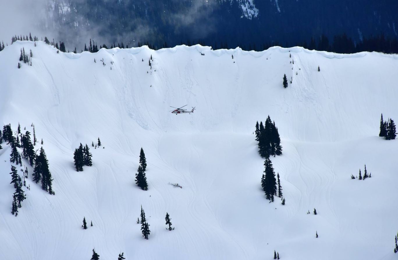
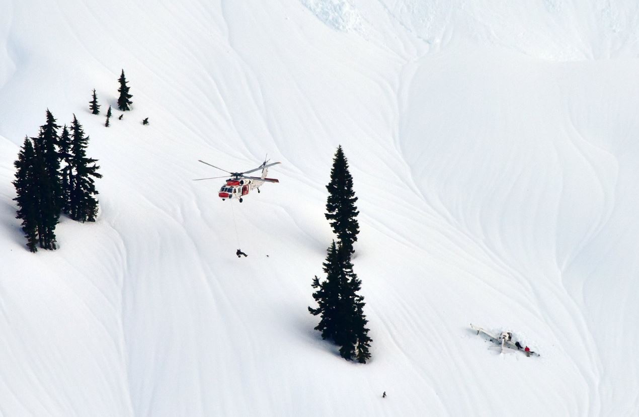
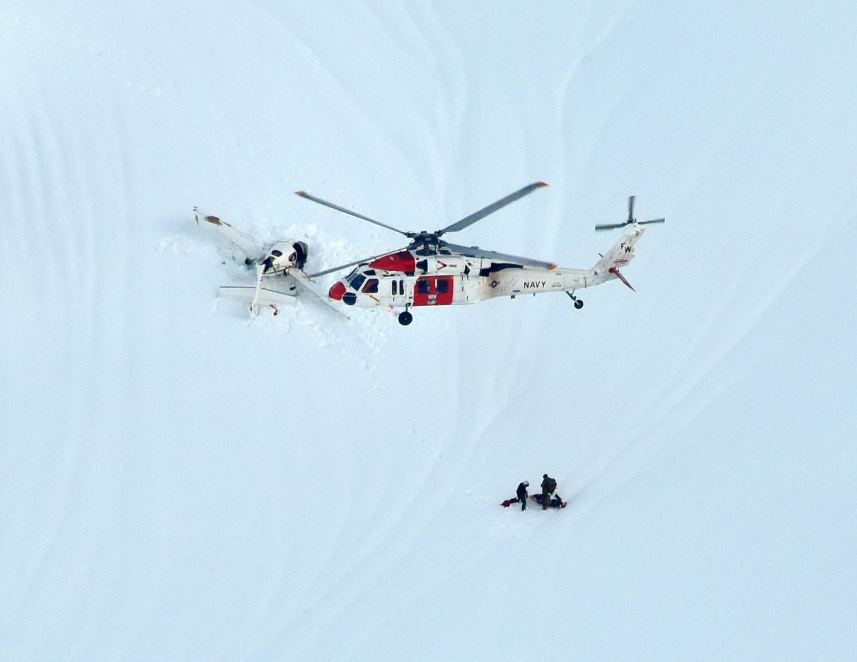
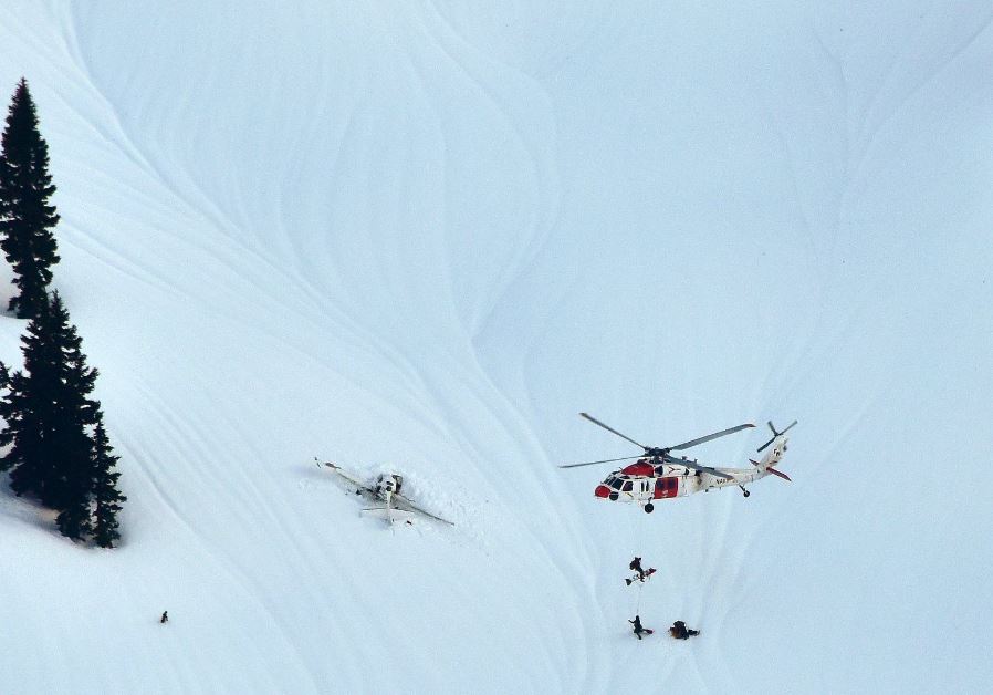
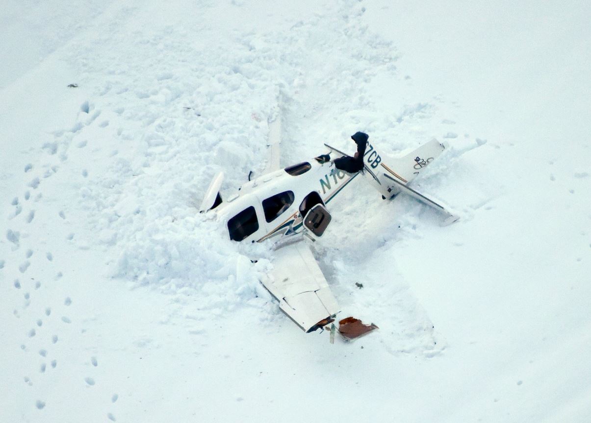
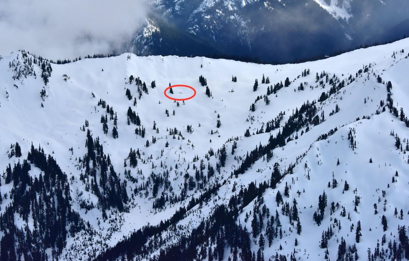
    On April 2, 2017, a small General Aviation aircraft crashed in an isolated part of the Olympic Mountains in Washington State.

    The Emergency Locator Transmitter (ELT) sent its 406 MHz distress signal via the NOAA Geostationary Operational Environmental Satellite (GOES) satellite and the new Medium-altitude Earth Orbiting Search and Rescue (MEOSAR) satellite constellation to NOAA ground stations around the United States.

    The distress alert was sent to the SARSAT United States Mission Control Center operated by NOAA.

    Within seconds from when the ELT was activated the MEOSAR constellation had provided an accurate location which was positively confirmed 20 minutes later.

    The combination of the accurate MEOSAR location from the 406 MHz signal as well as the 121.5 MHz homing capability of the ELT allowed rescue teams to pin point the location and perform a rescue on the side of the snow-covered Jupiter Mountain.

    The pilot and passenger survived the crash though minor injuries were reported.

    Photos

  • When a plane crashes on a mountain side and no one is around can you hear it? YES!

    On April 2, 2017, a small General Aviation aircraft crashed in an isolated part of the Olympic Mountains in Washington State.

    The Emergency Locator Transmitter (ELT) sent its 406 MHz distress signal via the NOAA Geostationary Operational Environmental Satellite (GOES) satellite and the new Medium-altitude Earth Orbiting Search and Rescue (MEOSAR) satellite constellation to NOAA ground stations around the United States.

    The distress alert was sent to the SARSAT United States Mission Control Center operated by NOAA.

    Within seconds from when the ELT was activated the MEOSAR constellation had provided an accurate location which was positively confirmed 20 minutes later.

    The combination of the accurate MEOSAR location from the 406 MHz signal as well as the 121.5 MHz homing capability of the ELT allowed rescue teams to pin point the location and perform a rescue on the side of the snow-covered Jupiter Mountain.

    The pilot and passenger survived the crash though minor injuries were reported.

    Photo credit: Long Bach Nguyen, Chief Pilot, Washington Air Search and Rescue.

    2017 04 10 1

    2017 04 10 2

    2017 04 10 3

    2017 04 10 4

    2017 04 10 5

    2017 04 10 6

  • 2017-03-31 Happy ending for French-Irish yacht caught in building-high Australian waters

    A Water Police officer had said if the yacht did survive, the currents would likely take her south.

    “And they were spot on,” the French yachter said.

    “This is like a Christmas present. We owe [the NSW Water Police] a lot. They’re such a professional bunch of guys.”

    The pair plans to continue the second half of their circumnavigation.

    Read more here:
    http://www.abc.net.au/news/2017-03-30/yacht-abandonded-after-rescue-recovered-off-eden/8402048 

  • 2017-03-21 AMSA and Navy aid South African nationals with broken mast in remote Southern Indian Ocean

    Three South African nationals have been rescued from their stricken yacht in the southern Indian Ocean by the Royal Australian Navy.

    AMSA’s Joint Rescue Coordination Centre (JRCC) in Canberra detected a distress beacon registered to a 13 metre yacht around 7 pm AEDT on Thursday, 17 March.

    The crew had reported to their shore contact that they had been demasted and were now unable to be contacted on their satellite phone or HF radio.

    Given the yacht’s remote location, AMSA engaged the Royal Australian Navy for assistance in rescuing the crew, and also tasked a search and rescue jet to their location, establishing VHF radio communication with the crew.

    In a second sortie on Friday afternoon, the jet successfully dropped a satellite telephone, marine VHF and aviation VHF to the crew.

    AMSA maintained regular satellite calls with the crew until the arrival of the Navy.

    An HMAS helicopter successfully winched all three crew members to safety and they are reported to be in good health.

    The rescue was the second major yacht rescue coordinated by AMSA in as many weeks, following the rescue of two internationals on 8 March in high seas.

    Read more:
    http://www.mysailing.com.au/cruising/south-african-nationals-rescued-from-stricken-yacht-in-indian-ocean#gGqgIpoDCl18hpfI.99 

    http://www.abc.net.au/news/2017-03-19/south-african-men-rescued-from-stricken-jedi-1-yacht-off-wa/8367580 

  • 2017-03-20 South Central Data Distribution Region (SCDDR) meeting

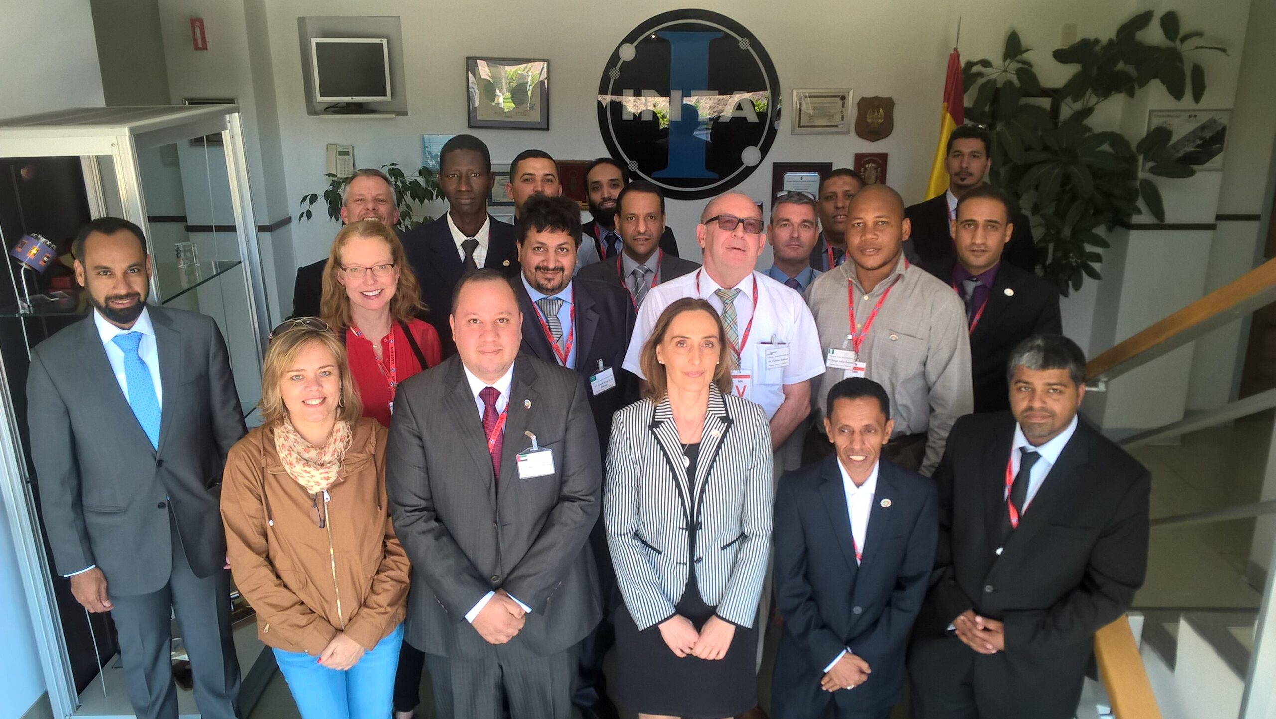
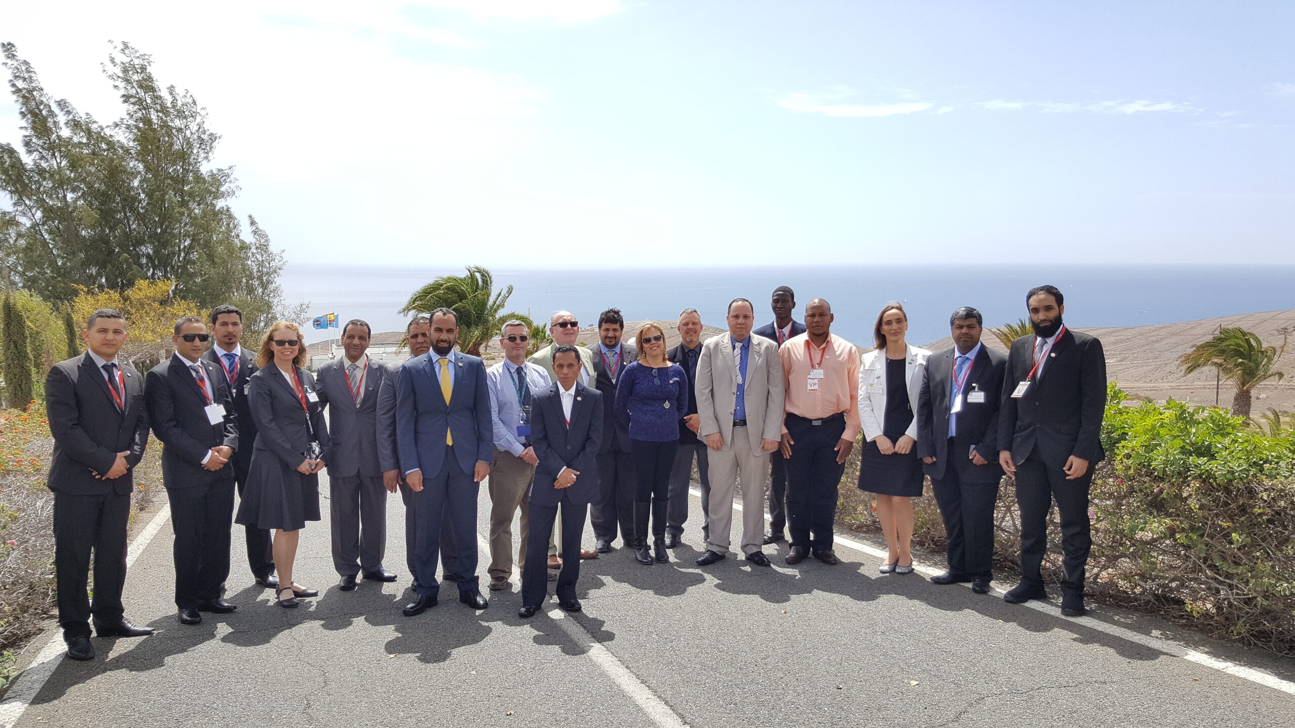
    The South Central Data Distribution Region (SCDDR) meeting was held from 14 to 16 March at the Spanish Mission Control Centre in Maspalomas, Spain.

    Participants focussed on the status of SCDDR MCCs and on issues associated with the Early Operational Capability (EOC) phase of MEOSAR and the operational aspects of the development of second-generation beacons and ELT(DT)s.

    The meeting was hosted by the Spanish MCC, supported by the Secretariat, and attended by representatives of the Algerian, Nigerian, Saudi Arabian and United Arab Emirates MCCs, as well as Qatar, a prospective Programme Participant.

    Photo 1

    Photo 2

This site is registered on wpml.org as a development site. Switch to a production site key to remove this banner.