Author: kevin

  • LEOSAR

    Cospas-Sarsat has demonstrated that the detection and location of 406 MHz distress beacon signals can be greatly facilitated by global monitoring based on low-altitude spacecraft in near-polar orbits. Complete, yet non continuous coverage of the Earth is achieved using simple emergency beacons operating on 406 MHz to signal a distress. The coverage is not continuous because polar orbiting satellites can only view a portion of the Earth at any given time (see figure at left). Consequently the System cannot produce distress alerts until the satellite is in a position where it can “see” the distress beacon. However, since the satellite onboard 406 MHz processor includes a memory module, the satellite is able to store distress beacon information and rebroadcast it when the satellite comes within view of a LUT, thereby providing global coverage.

    As described above, a single satellite, circling the Earth around the poles, eventually views the entire Earth surface. The “orbital plane”, or path of the satellite, remains fixed, while the Earth rotates underneath it. At most, it takes only one half rotation of the Earth (i.e. 12 hours) for any location to pass under the orbital plane. With a second satellite, having an orbital plane at right angles to the first, only one quarter of a rotation is required, or 6 hours maximum. Similarly, as more satellites orbit the Earth in different planes, the waiting time is further reduced. The Cospas-Sarsat System design constellation is four satellites which provide a typical waiting time of less than one hour at mid-latitudes.

    The LEOSAR system calculates the location of distress events using Doppler processing techniques. Doppler processing is based upon the principle that the frequency of the distress beacon, as “heard” by the satellite instrument, is affected by the relative velocity of the satellite with respect to the beacon. By monitoring the change of the beacon frequency of the received beacon signal and knowing the exact position of the satellite, the LUT is able to calculate the location of the beacon.

  • Overview

     Operational use of Cospas-Sarsat by SAR agencies started with the crash of a light aircraft in Canada, in which three people were rescued (September 10, 1982). Since then, the System has been used for thousands of SAR events and has been instrumental in the rescue of over 33,000 lives worldwide.

    The basic Cospas-Sarsat concept is illustrated in the adjacent figure. The System is composed of:

    The Cospas-Sarsat System includes two types of satellites:

    • satellites in low-altitude Earth orbit (LEO) which form the LEOSAR System

    • satellites in geostationary Earth orbit (GEO) which form the GEOSAR System

    Cospas-Sarsat has demonstrated that the GEOSAR and LEOSAR system capabilities are complementary. For example the GEOSAR system can provide almost immediate alerting in the footprint of the GEOSAR satellite, whereas the LEOSAR system:

    • provides coverage of the polar regions (which are beyond the coverage of geostationary satellites);

    • can calculate the location of distress events using Doppler processing techniques; and

    • is less susceptible to obstructions which may block a beacon signal in a given direction because the satellite is continuously moving with respect to the beacon.

    LEOSAR and GEOSAR Capabilities

    LEOSAR

    GEOSAR

    • Beacon identification information and location information provided

    • Global coverage, but not instantaneous

    • Beacon identification provided, and location information available if encoded in beacon message (location protocol beacon)

    • Near instantaneous alerting in the GEOSAR coverage area 

    For a more detailed description of the Cospas-Sarsat System see document C/S G.003 “Introduction to the Cospas-Sarsat System”.

  • How to Test your 406 MHz Cospas-Sarsat Beacon?


    Activating a 406 MHz beacon for even a very short time will generate a Cospas-Sarsat distress alert message that will be relayed to Search and Rescue Services for their immediate action. 

    (more…)

  • What is the IBRD?

    Beacon owners can directly register a beacon, when the beacon’s country code corresponds to that of an Administration that allows registration on the IBR ; and search and rescue services can easily upload or retrieve beacon registration information.

    (more…)

  • Local User Terminals (LUTs)

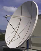
    LUTThere are three types of LUTs in the Cospas-Sarsat System, each corresponding to the type of satellite constellation that they operate with: LEOLUTs for the LEOSAR system, GEOLUTs for the GEOSAR system, and MEOLUTs for the MEOSAR system.

    LEOLUT GEOLUT and MEOLUT operators provide the SAR community with reliable alert and location data without restriction on its use and distribution. The Cospas-Sarsat Space Segment Providers supply LUT operators with the System data that is required to operate their LUTs. To ensure that the data provided by LUTs is reliable and can be used by the SAR community on an operational basis, Cospas-Sarsat has developed LUT performance specifications and procedures. Copies of the LUT specifications (documents C/S T.002 for LEOLUTs, C/S T.009 for GEOLUTs and C/S T.019 for MEOLUTs) and commissioning standards (documents C/S T.005 for LEOLUTs, C/S T.010 for GEOLUTs and C/S T.020 for MEOLUTs) are available for download under the “System Documents” section of the Professionals website (Pro/Documents).


    LEOLUTs

    [Map of LEOLUT Locations]

    The configuration and capabilities of each LEOLUT may vary to meet the specific requirements of the participating countries, but the Cospas and Sarsat LEOSAR spacecraft downlink signal formats ensure interoperability between the various spacecraft and all LEOLUTs meeting Cospas-Sarsat specifications.

    The capability of a LEOLUT is determined, for the most part, by the LEOSAR satellite channels it was designed to process. There are a possible 2 channels that may, depending upon the specific satellite being tracked, be available for processing. Some satellites support all the channels listed below, and some only support a limited set of them.

    • The 406-MHz Search and Rescue Processor (SARP) satellite channel transmits received 406-MHz beacon data that has already been partially processed by the satellite to determine the identification, transmit time, and received frequency for each distress beacon transmission burst. Because of the on-board memory capability of the SARP channel, this channel provides global (yet not continuous) coverage for distress beacons that operate at 406 MHz.

    • The 406-MHz Search and Rescue Repeater (SARR) channel receives 406-MHz beacon transmission bursts and immediately retransmits them on the satellite downlink. Since there is no memory associated with the repeater channel, this type of processing supports only local mode coverage (i.e., the distress beacon and the LEOLUT must be in simultaneous view of the satellite for a period of time). Furthermore, since the satellite does not process the data, all the processing is performed by the LEOLUT.

    For 406-MHz signals received via their respective SARR channel, each transmission is detected and the Doppler information calculated. A beacon position is then determined using this data. The LUT is also able to provide identification information associated with the beacon.

    Processing the SARP channel 2400-bps data (i.e., those generated from 406-MHz transmissions) is relatively straightforward since the Doppler frequency is measured and time-tagged on-board the spacecraft. All 406-MHz data received from the satellite memory on each pass can be processed within a few minutes of pass completion.

    To maintain accurate location processing, an update of the satellite ephemeris is produced each time the LUT receives a satellite signal. The downlink carrier is monitored to provide a Doppler signal using the LUT location as a reference, or highly stable 406-MHz calibration beacons at accurately known locations are used to update the ephemeris data.


    GEOLUTs

    [Map of GEOLUT Locations]

    GEOLUTA GEOLUT is a ground receiving station in the Cospas-Sarsat System that receives and processes 406-MHz distress beacon signals which have been relayed by a Cospas-Sarsat geostationary satellite. Due to the extremely large continuous coverage footprint provided by each geostationary satellite, GEOLUTs are able to produce near-instantaneous alerting over extremely large areas. However, due to the fact that the satellite remains stationary with respect to distress beacons, GEOLUTs are not able to determine beacon locations using Doppler processing techniques. In view of this, 406-MHz beacons with location protocols allow for the encoding of GNSS position data in the transmitted 406-MHz message, thus providing for quasi-real-time alerting with position information via the GEOSAR system.

    The “GEOLUT Availability Table” provides an indication of which GEOSAR satellite is tracked by which specific GEOLUT (Pro/System/System Monitoring/Availability Tables (QMS)).


    MEOLUTs

    [map of MEOLUT Locations] to come
    [photo of a MEOLUT] to come

    A MEOSAR Local User Terminal (MEOLUT) is a ground receiving station in the Cospas-Sarsat MEOSAR system that detects, characterizes and locates 406-MHz beacons, and forwards the beacon distress alert and location data to its associated Cospas-Sarsat Mission Control Centre (MCC).

    The MEOLUT simultaneously tracks several medium earth orbiting (MEO) satellites of the BDS, Galileo, GPS and Glonass constellations that embark Search and Rescue (SAR) repeaters in addition to their primary GNSS payloads. The MEOLUT receives and processes the beacon signals relayed by those satellites and measures the received frequency and time of the beacon bursts. The MEOLUT calculates the uplink frequency of arrival (FOA) and time of arrival (TOA) of the detected beacon bursts at the satellite for each satellite channel. If the beacon burst is received from at least three MEOSAR satellites, the MEOLUT then calculates an unambiguous location for the beacon from the uplink TOA and FOA data. This methodology to determine beacon locations independently from GNSS signals is referred to as the Frequency Difference of Arrival/Time Difference of Arrival (FDOA/TDOA) location method. The MEOLUT can improve the accuracy of the beacon location over the first burst by combining data from subsequent bursts as they are received.

    In addition, a MEOLUT may be exchanging data with other MEOLUTs, which allows increasing the number of TOA/FOA measurements used to locate beacons, thus increasing the beacon location accuracy and extending the coverage of the “networked” MEOLUTs.


  • Beacon Carriage

    The use of special-purpose radiobeacons, either manually or automatically activated by an aircraft crash or maritime distress situation, reduces the time required to alert the appropriate authorities and for final location of the distress site by the rescue team

    IMO Requirements

    The 1988 amendment to the Convention for the Safety of Life at Sea, 1974 (SOLAS Convention) establishing the Global Maritime Distress and Safety System (GMDSS) mandates that ships of 300 tons and over carry a Satellite Emergency Position Indicating Radio Beacon (Satellite EPIRB). This carriage requirement became effective on 1 August 1993. Cospas-Sarsat compatible 406 MHz EPIRBs satisfy the alerting requirement of the GMDSS.

    ICAO Requirements

    The International Civil Aviation Organization (ICAO) recommends that, from July 2008, all aircraft under the jurisdiction of the ICAO Convention carry an Emergency Locator Transmitter (ELT) operating on the frequency 406 MHz for compatibility with the Cospas-Sarsat System, and on 121.5 MHz for “homing” purposes.

    National Requirements

    Various national requirements also exist for the carriage of ELTs/EPIRBs on various types of craft not otherwise subject to international conventions, and some countries have authorised the use of 406 MHz Personal Locator Beacons (PLBs) on land, in remote or rugged areas.

    A large number of 121.5 MHz beacons are installed on board light aircraft and carried on board pleasure craft, either as a result of voluntary fitting or in response to specific national carriage requirements. These users should consider replacing their 121.5 MHz beacons with 406 MHz beacons as the satellite processing of 121.5 MHz emission was terminated on 1 February 2009.

  • Beacon FAQ

    What is a Cospas-Sarsat beacon?

    A Cospas-Sarsat beacon, also called a distress radio beacon or emergency beacon, is a radio transmitter that can be activated in a life-threatening emergency to summon assistance from government authorities.

    A beacon designed for use in an aircraft is known as an Emergency Locator Transmitter (ELT). One designed for use aboard a marine vessel is called an Emergency Position-Indicating Radio Beacon (EPIRB). And one that is designed to be carried by an individual is known as a Personal Locator Beacon (PLB). Sometimes PLBs are carried aboard aircraft or vessels, but you must check with local authorities about the circumstances under which this is permitted. Some ELTs (often older models) transmit only a legacy analogue signal on 121.5 MHz or 243 MHz. Cospas-Sarsat does NOT monitor those frequencies and such beacons rely on being received only by nearby aircraft or rescue personnel. For satellite reception of alerts by Cospas-Sarsat the beacon must be a model that transmits at 406 MHz.

    How does a distress beacon work?

    When a distress beacon is activated, it transmits a signal that can be detected by satellites. As the satellites orbit the earth, they “listen” for any activated beacons and carry the beacon signals to ground stations that compute their positions and report to rescue authorities.
    For more details see “Cospas-Sarsat System” (Public/System Overview).

    What is a Hex ID, and where can I find mine?

    The Hex ID is a 15 hexadecimal character string (valid range: numbers 0 through 9 and letters A through F), referred to as the beacon 15 Hex Identification, or 15 Hex ID. Your beacon’s 15 character Hex ID uniquely identifies your 406-MHz beacon and is encoded in the message your beacon transmits to search and rescue services if your beacon is activated. When your beacon is activated satellites will detect the transmission and relay the distress alert to search and rescue services. The Hex ID contains the country code and other identification features relative to the carrier which are dependent upon the coding protocol used. The Hex ID can identify the carrier using the radio call sign, a serial number, aircraft registration marking, etc.
    You should find your beacon’s Hex ID on a label affixed to the beacon or in the beacon documentation provided by your beacon manufacturer. If you have difficulty locating your beacon Hex ID, contact your beacon manufacturer.

    What happens if I do not register my emergency beacon?

    The System will still work but not registering your beacon defeats the purpose of owning a beacon and taking advantage of current technology. The Cospas-Sarsat System is designed to provide both identification and location information. Identification information such as the radio call sign or aircraft tail number can be encoded into the emergency beacon. If the beacon is encoded with a serial number, it is very important that it be registered as no information about the beacon user can be encoded in the beacon’s message. Furthermore some countries mandate registration by law and there may be penalties for not registering.

    As long as the System is able to obtain a position (either using Doppler processing or through the use of beacons that can transmit their position as part of the 406-MHz message), search and rescue personnel can respond to a distress signal. However, when a position is not available, search and rescue personnel have to rely on registration information. It is in these cases that rescue could be delayed until the System can obtain a position. Even with a position, the response may be delayed until the search and rescue personnel determine the nature of the distress and their capability to respond to the location of the distress. When registering a beacon, try to list two contacts, one of which the search and rescue personnel would be able to reach at any time of the day.

    Beacons can be stolen and activated maliciously and they can be activated accidentally if not cared for in a proper manner. In such circumstances the registration data can be used to contact the owner and/or emergency contacts to establish that an emergency situation does not exist. This can assist the owner to remedy a fault if one exists and it can assist the SAR authority to take appropriate action if no emergency exists. This means that your registration can help avoid the unnecessary use of valuable SAR resources and putting rescuers lives at risk.

    What if I accidentally activate my beacon?

    The most important thing is to turn it off and let the Search and Rescue Authorities know as soon as you can. There is no penalty for accidentally activating your beacon.

    We have multiple beacons. What should we do if our group is in a situation with multiple beacons that are available to be activated?

    The guidelines and examples available on this page: Guidance on Multiple Beacon Activation provide advice on activating Cospas-Sarsat beacons if multiple Cospas-Sarsat beacons are available in a distress situation.

    How should I maintain my beacon and battery?

    406-MHz distress beacons are safety-of-life devices. They are complex radio transmitters and their proper functioning in an emergency depends on proper maintenance. You MUST maintain your 406-MHz distress beacon in accordance with the instructions of the manufacturer. For aviation ELTs and marine EPIRBs, the requirements and procedures for maintenance of beacons and their external components are generally subject to national regulations or international standards. Beacon maintenance requirements also may be regulated by local authorities. Typically, maintenance procedures include, but are not limited to:

    Periodic physical inspections,
    Periodic beacon self-tests,
    Battery replacement accordingly to manufacturer instructions,
    Periodic technical inspection and service by a service center approved by the beacon manufacturer agents.
    It is important that beacon owners perform regular visual inspections of their beacons to look for physical damage, such as cracks or corrosion, in the case or other parts which could cause false activation of the beacon and/or cause the beacon to fail when activated in a real emergency.

    The beacon self-test feature, which is described in the beacon owner’s manual, is designed to verify proper operation of beacon electronics by checking all key features, including the radio transmitter and battery. Beacon self-tests can be performed by the beacon owner. Self-tests should be performed at regular time intervals, as recommended by the beacon manufacturer. Immediately contact the beacon manufacturer if a self-test indicates a failure. Avoid conducting self-tests more frequently than recommended by the manufacturer, unless you have reason to suspect a problem with a beacon. For battery-powered beacons, activating the beacon self-test consumes a small amount of the beacon’s battery energy. Therefore, excessive self-test activations may prematurely deplete the beacon battery, causing inadequate battery performance in an emergency.

    Battery replacement must be performed no later than the date indicated on the beacon label, or after activation in an emergency. During each routine inspection, verify the time remaining until replacement is required. You may also need to replace the battery earlier than indicated on the label if you have conducted an excessive number of self-tests. A healthy battery is necessary to ensure proper functioning, and sufficient operating life, of a beacon if it is activated in an emergency.

    Always use replacement batteries that have been approved as a part of the original Cospas-Sarsat type approval, and as directed by the beacon manufacturer or one of its approved service centers. Use of after-market batteries not approved by the manufacturer (purchased, for example, from some on-line vendors) could result in inadequate beacon performance during an emergency.

    If you have questions about the maintenance of, or battery replacement for, your beacon, please consult the beacon manufacturer using contact information in the user manual. You also may find contact information for beacon manufacturers on the “Contact Lists” tab of our Professionals home page.

  • How Do I Select and Purchase a 406-MHz Cospas-Sarsat Beacon?

    How Do I Select and Purchase a 406-MHz Cospas-Sarsat Beacon?


    Beacons are manufactured, marketed and sold competitively by several different companies through a variety of vendor chains.

    Cospas-Sarsat (working with the manufacturer and independent laboratories) rigorously tests and “type approves” beacon models before they go into production to ensure that production beacons sold to the public can be expected to operate under a variety of extreme conditions.

    The International Cospas-Sarsat Programme does not itself manufacture, market or sell beacons. A list of manufacturers is available at our Professionals website under “Contact Lists” (Pro).

    The first consideration in selecting a beacon is the type of environment in which you expect to use it. A 406-MHz beacon designed for use in an aircraft is known as an Emergency Locator Transmitter (ELT).[1] One designed for use aboard a marine vessel is called an Emergency Position-Indicating Radio Beacon (EPIRB). And one that is designed to be carried by an individual (such as while hiking/trekking) is known as a Personal Locator Beacon (PLB). Sometimes PLBs are carried aboard aircraft or vessels, but you must check with local authorities about the circumstances under which this is permitted.

    Beacons have different features for activation in an emergency. Most beacons can be activated manually by a person pressing a button. Most ELTs are designed to be activated automatically by a physical shock, such as in a crash, and most EPIRBs are designed to be automatically activated by contact with water. Some EPIRBs are designed to be held in a bracket outside of the vessel such that it will “float free” and activate automatically if the vessel sinks. PLBs usually have only a manual activation capability. There are many variations of activation and deployment features for beacons to suit many, many different situations and needs, so you should evaluate these features carefully.

    During type-approval testing, beacon models are evaluated to one of two temperature extremes: -40 degrees Celsius (which receives a Class 1 type approval) and -20 degrees Celsius (which receives a Class 2 type approval).

    Many beacon models not only transmit a distress message on 406 MHz for satellite reception, they also transmit a lower powered signal on 121.5 MHz as a reference for local search teams to “home” in on the signal once they arrive near the location calculated for the beacon. In some countries such a “homing transmitter” is a mandatory beacon feature.

    Although the Cospas-Sarsat System is designed to independently locate activated distress beacons with good accuracy, many beacons now also are equipped with an integrated receiver chip for the beacon to determine its own location using signals from global navigation satellite systems (GNSS), such as GPS, GLONASS or GALILEO. If the integrated receiver chip is able to calculate a location for the beacon, that location is reported in the distress message transmitted from the beacon. GNSS-equipped beacons provide helpful redundancy in determining the beacon location and in certain circumstances can reduce the time needed for Cospas-Sarsat to locate the beacon.

    Some aviation ELTs and marine EPIRBs may have an interface that allows the beacon to have location data reported to it by the avionics or marine electronics so that the information is continuously updated, stored and available to be transmitted if the beacon is activated.

    A list of type-approved beacon models with some details about model features is available on our Professionals website under “Approved Beacon Models” (Pro/Beacons/Beacon Information).

    A few beacons, with exceptional characteristics, may not meet all of the standards for type-approval, but still may be approved for use with Cospas-Sarsat by virtue of a “letter of compatibility”. Such beacons may be perfectly suitable for your particular needs, but you will need to take extra care to be certain that is the case.

    While Cospas-Sarsat (working with the manufacturer and independent laboratories) rigorously tests and “type approves” beacon models before they go into production to ensure that production beacons sold to the public can be expected to operate under a variety of extreme conditions, Cospas-Sarsat type approval alone does NOT qualify the beacon for sale or use in any particular country, nor determine whether the beacon satisfies local and international regulatory requirements regarding aircraft and vessels. You must check with your local authorities about the number and types of beacons that may be required on your aircraft or vessel. Some of this information may be found in the “Beacon Regulations Handbook” (Pro/Beacons/Beacon Information).

    If your aircraft/vessel makes international voyages, you may be subject to specific requirements established by the International Civil Aviation Organization (e.g., Annex 6, Part 1 of the ICAO Convention) or the International Maritime Organization (e.g., Chapter IV of the IMO’s Convention on Safety of Life at Sea).

    Beacon manufacturers establish their own marketing and retailing chains. Aviation ELTs usually can be purchased at aviation equipment supply stores or service facilities. Similarly, marine EPIRBs usually can be purchased at marine supply stores or service facilities. PLBs usually can be purchased at sporting-goods and outdoor-goods stores. Beacons of all types can be purchased from vendors on the internet. Please note that if you purchase a beacon from a vendor in a country different from the one where your aircraft/vessel is flagged, or different from your country of residence, in order to successfully register the beacon you may need to have the “country code” that has been electronically encoded in the beacon reprogrammed to a new (your current) country code by an authorized service facility at an additional cost.


    [1] Some ELTs (often older models) transmit only a legacy analogue signal on 121.5 MHz or 243 MHz. Cospas-Sarsat does NOT monitor those frequencies and such beacons rely on being received only by nearby aircraft or rescue personnel. For satellite reception of alerts by Cospas-Sarsat the beacon must be a model that transmits at 406 MHz.

  • EPIRB alert provides location for sinking fishing vessel in North Sea

    EPIRB alert provides location for sinking fishing vessel in North Sea

    The 23.1m twin-rig trawler was reportedly around 140 miles east of Montrose, Scotland, when she transmitted a distress signal requesting assistance.

    All vessels in the vicinity were requested to assist in a rescue operation overseen by the Marine Rescue Co-ordination Centre.

    A nearby fishing vessel responded and was able to track the 406 EPIRB distress beacon, which had been activated when ship sank.

    Thankfully the vessel located the six-man crew all safe and well aboard its liferaft, and was able to transfer them safely aboard.

    A fixed-wing search aircraft was deployed by HM Coastguard, and a rescue helicopter was sent to the scene from Norway.

    Read more here:
    https://fishingnews.co.uk/news/odyssey-sinks-in-north-sea/

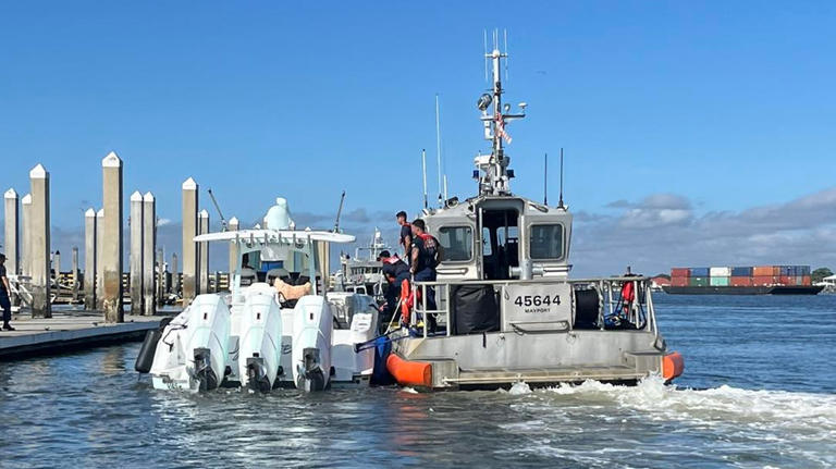
  • 406 EPIRB leads US Coast Guard to two boaters and their dog 55 miles from Florida coast

    406 EPIRB leads US Coast Guard to two boaters and their dog 55 miles from Florida coast

    Two people and their dog were rescued after their boat stopped working over 50 miles from shore over the weekend.

    The U.S. Coast Guard said the 38-foot boat stopped working 55 miles from Palm Coast.

    Following a 406 beacon distress signal from an EPIRB, a Clearwater station aircraft was able to find the stranded boaters and guide water crews to their location.

    Read more here:
    https://www.msn.com/en-us/news/us/coast-guard-rescues-2-people-and-their-dog-55-miles-from-florida-coast/ar-BB1peiQV

This site is registered on wpml.org as a development site. Switch to a production site key to remove this banner.