Author: kevin

  • How Do I Select and Purchase a 406-MHz Cospas-Sarsat Beacon?

    How Do I Select and Purchase a 406-MHz Cospas-Sarsat Beacon?


    Beacons are manufactured, marketed and sold competitively by several different companies through a variety of vendor chains.

    Cospas-Sarsat (working with the manufacturer and independent laboratories) rigorously tests and “type approves” beacon models before they go into production to ensure that production beacons sold to the public can be expected to operate under a variety of extreme conditions.

    The International Cospas-Sarsat Programme does not itself manufacture, market or sell beacons. A list of manufacturers is available at our Professionals website under “Contact Lists” (Pro).

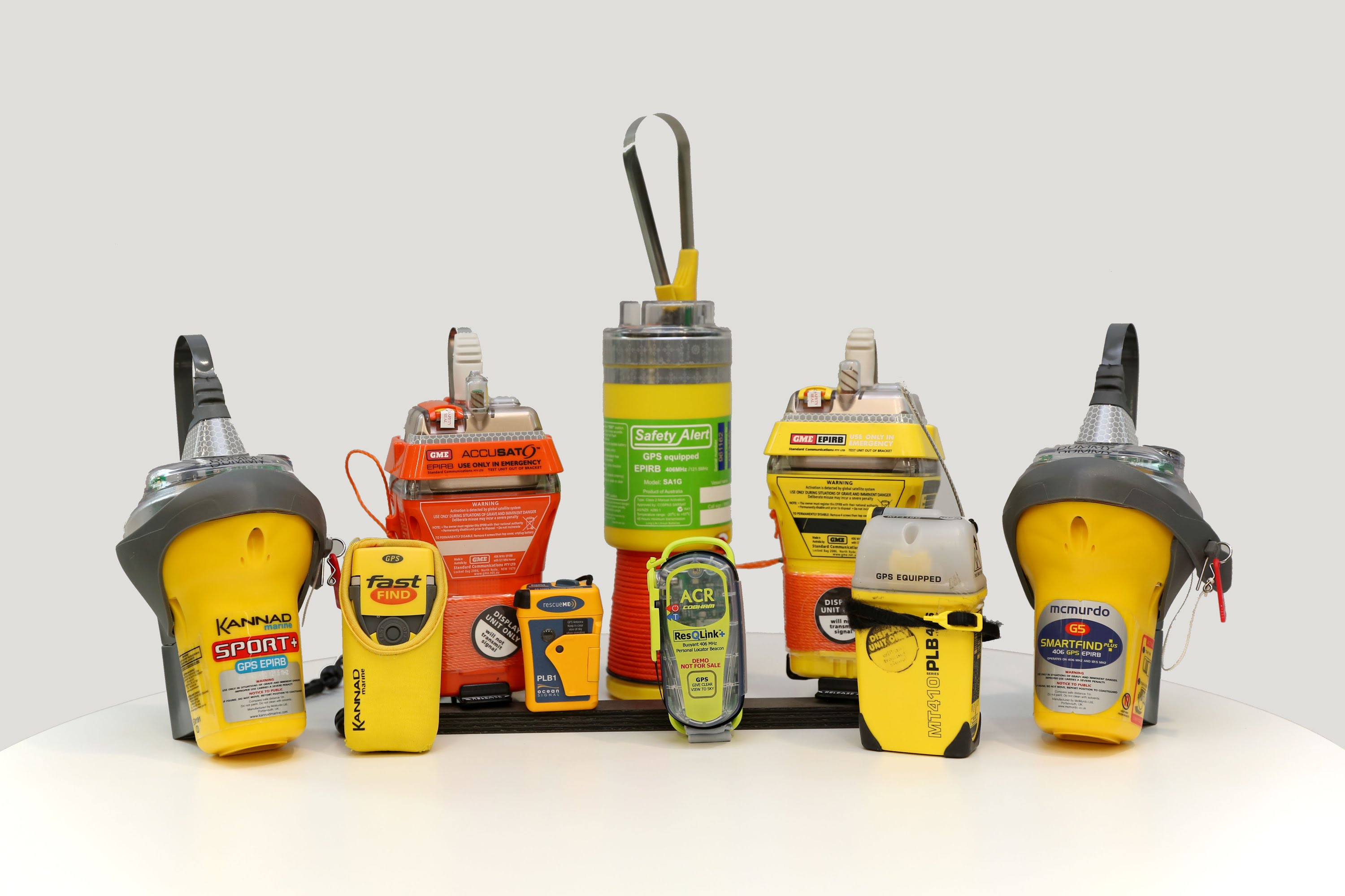
    The first consideration in selecting a beacon is the type of environment in which you expect to use it. A 406-MHz beacon designed for use in an aircraft is known as an Emergency Locator Transmitter (ELT).[1] One designed for use aboard a marine vessel is called an Emergency Position-Indicating Radio Beacon (EPIRB). And one that is designed to be carried by an individual (such as while hiking/trekking) is known as a Personal Locator Beacon (PLB). Sometimes PLBs are carried aboard aircraft or vessels, but you must check with local authorities about the circumstances under which this is permitted.

    Beacons have different features for activation in an emergency. Most beacons can be activated manually by a person pressing a button. Most ELTs are designed to be activated automatically by a physical shock, such as in a crash, and most EPIRBs are designed to be automatically activated by contact with water. Some EPIRBs are designed to be held in a bracket outside of the vessel such that it will “float free” and activate automatically if the vessel sinks. PLBs usually have only a manual activation capability. There are many variations of activation and deployment features for beacons to suit many, many different situations and needs, so you should evaluate these features carefully.

    During type-approval testing, beacon models are evaluated to one of two temperature extremes: -40 degrees Celsius (which receives a Class 1 type approval) and -20 degrees Celsius (which receives a Class 2 type approval).

    Many beacon models not only transmit a distress message on 406 MHz for satellite reception, they also transmit a lower powered signal on 121.5 MHz as a reference for local search teams to “home” in on the signal once they arrive near the location calculated for the beacon. In some countries such a “homing transmitter” is a mandatory beacon feature.

    Although the Cospas-Sarsat System is designed to independently locate activated distress beacons with good accuracy, many beacons now also are equipped with an integrated receiver chip for the beacon to determine its own location using signals from global navigation satellite systems (GNSS), such as GPS, GLONASS or GALILEO. If the integrated receiver chip is able to calculate a location for the beacon, that location is reported in the distress message transmitted from the beacon. GNSS-equipped beacons provide helpful redundancy in determining the beacon location and in certain circumstances can reduce the time needed for Cospas-Sarsat to locate the beacon.

    Some aviation ELTs and marine EPIRBs may have an interface that allows the beacon to have location data reported to it by the avionics or marine electronics so that the information is continuously updated, stored and available to be transmitted if the beacon is activated.

    A list of type-approved beacon models with some details about model features is available on our Professionals website under “Approved Beacon Models” (Pro/Beacons/Beacon Information).

    A few beacons, with exceptional characteristics, may not meet all of the standards for type-approval, but still may be approved for use with Cospas-Sarsat by virtue of a “letter of compatibility”. Such beacons may be perfectly suitable for your particular needs, but you will need to take extra care to be certain that is the case.

    While Cospas-Sarsat (working with the manufacturer and independent laboratories) rigorously tests and “type approves” beacon models before they go into production to ensure that production beacons sold to the public can be expected to operate under a variety of extreme conditions, Cospas-Sarsat type approval alone does NOT qualify the beacon for sale or use in any particular country, nor determine whether the beacon satisfies local and international regulatory requirements regarding aircraft and vessels. You must check with your local authorities about the number and types of beacons that may be required on your aircraft or vessel. Some of this information may be found in the “Beacon Regulations Handbook” (Pro/Beacons/Beacon Information).

    If your aircraft/vessel makes international voyages, you may be subject to specific requirements established by the International Civil Aviation Organization (e.g., Annex 6, Part 1 of the ICAO Convention) or the International Maritime Organization (e.g., Chapter IV of the IMO’s Convention on Safety of Life at Sea).

    Beacon manufacturers establish their own marketing and retailing chains. Aviation ELTs usually can be purchased at aviation equipment supply stores or service facilities. Similarly, marine EPIRBs usually can be purchased at marine supply stores or service facilities. PLBs usually can be purchased at sporting-goods and outdoor-goods stores. Beacons of all types can be purchased from vendors on the internet. Please note that if you purchase a beacon from a vendor in a country different from the one where your aircraft/vessel is flagged, or different from your country of residence, in order to successfully register the beacon you may need to have the “country code” that has been electronically encoded in the beacon reprogrammed to a new (your current) country code by an authorized service facility at an additional cost.


    [1] Some ELTs (often older models) transmit only a legacy analogue signal on 121.5 MHz or 243 MHz. Cospas-Sarsat does NOT monitor those frequencies and such beacons rely on being received only by nearby aircraft or rescue personnel. For satellite reception of alerts by Cospas-Sarsat the beacon must be a model that transmits at 406 MHz.

  • EPIRB alert provides location for sinking fishing vessel in North Sea

    EPIRB alert provides location for sinking fishing vessel in North Sea

    The 23.1m twin-rig trawler was reportedly around 140 miles east of Montrose, Scotland, when she transmitted a distress signal requesting assistance.

    All vessels in the vicinity were requested to assist in a rescue operation overseen by the Marine Rescue Co-ordination Centre.

    A nearby fishing vessel responded and was able to track the 406 EPIRB distress beacon, which had been activated when ship sank.

    Thankfully the vessel located the six-man crew all safe and well aboard its liferaft, and was able to transfer them safely aboard.

    A fixed-wing search aircraft was deployed by HM Coastguard, and a rescue helicopter was sent to the scene from Norway.

    Read more here:
    https://fishingnews.co.uk/news/odyssey-sinks-in-north-sea/

  • 406 EPIRB leads US Coast Guard to two boaters and their dog 55 miles from Florida coast

    406 EPIRB leads US Coast Guard to two boaters and their dog 55 miles from Florida coast

    Two people and their dog were rescued after their boat stopped working over 50 miles from shore over the weekend.

    The U.S. Coast Guard said the 38-foot boat stopped working 55 miles from Palm Coast.

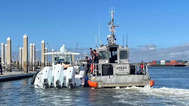
    Following a 406 beacon distress signal from an EPIRB, a Clearwater station aircraft was able to find the stranded boaters and guide water crews to their location.

    Read more here:
    https://www.msn.com/en-us/news/us/coast-guard-rescues-2-people-and-their-dog-55-miles-from-florida-coast/ar-BB1peiQV

  • 2023-08-08 | Before you go hiking, read these life-saving tips from first responders

    National Geographic magazine recommends carriage of a distress beacon as the best safety tool for climbers and trekkers.

    Thousands of people go missing every year while exploring mountains, forests, rivers, and deserts. Safety experts tell us how to avoid mishaps—and what to do if you need rescuing.

    https://www.nationalgeographic.com/travel/article/safety-tips-from-first-responders-you-need-to-know

  • Quick Statistics

     These statistics are copied from the latest issue of the System Data document, which is available here: http://www.cospas-sarsat.int/en/documents-pro/system-data.


    As of December 2015 the Cospas-Sarsat System had provided assistance in rescuing at least 41,750 persons in over 11,788 SAR events.

    As of April 2017:

    Governments and Agencies that are Cospas-Sarsat Programme “Participants”


    4 Parties to the Cospas-Sarsat Agreement

    29 Ground Segment Providers

    9 User States

    2 Participating Organisations

    Total = 44 Participants


    The Components of the Cospas-Sarsat System

    Distress Beacons Worldwide about 2,000,000

    Ground Segment

    Mission Control Centres (MCCs): 30

    LEOLUTs: 53

    GEOLUTs: 21

    Space Segment 

    LEOSAR satellites: 5

    GEOSAR satellites: 5


    System Operation

    A more detailed description of the System status is provided in the Cospas-Sarsat “System Data” document available on our Professionals website (Pro/Documents). 

    This document includes:

    • Statistics on the number of SAR events assisted by Cospas-Sarsat, and the number of lives rescued in these events

    • Maps depicting LEOSAR and GEOSAR coverage

    • The list of countries and organisations which participate in the management of the Programme and System operation

    • Space and ground segment equipment availability

    • The list of type approved 406 MHz beacons and beacon manufacturers

    • Estimated beacon population


  • Statistics

    These statistics are copied from the latest issue of the System Data document, which is available here: http://www.cospas-sarsat.int/en/documents-pro/system-data.

    Geographic Distribution of Confirmed SAR Events for which Cospas-Sarsat Data was Used

    (January to December 2015)

    Geogr Dist SAR 2015

    Distribution of SAR Events Assisted by Cospas-Sarsat by Type of Events
    (January to December 2015)


     Type of SAR Events 2015


    Persons Rescued by Type of SAR Event Assisted by Cospas-Sarsat 
    (January to December 2015)

    Persons Rescued 2015

    Number of SAR Events and Persons Rescued with the Assistance of Cospas-Sarsat Alert Data

    (121.5 and 406 MHz)

    (January 1994 to December 2015)

    Persons Rescued 2015 bar Graph

    Number of SAR Events Assisted 

    by Cospas-Sarsat (January to December 2015)

    Number of SAR Events 2015 Bar Graph


  • Cospas-Sarsat System

    The basic Cospas-Sarsat concept is illustrated in the adjacent figure. The System is composed of:

    • distress radiobeacons (ELTs for aviation use, EPIRBs for maritime use, and PLBs for personal use) which transmit signals during distress situations;

    • instruments on board satellites in geostationary and low-altitude Earth orbits which detect the signals transmitted by distress radiobeacons;

    • ground receiving stations, referred to as Local Users Terminals (LUTs), which receive and process the satellite downlink signal to generate distress alerts; and

    • Mission Control Centers (MCCs) which receive alerts produced by LUTs and forward them to Rescue Coordination Centers (RCCs), Search and Rescue Points Of Contacts (SPOCs) or other MCCs.

    The Cospas-Sarsat System includes two types of satellites:

    • satellites in low-altitude Earth orbit (LEO) which form the LEOSAR System
    • satellites in geostationary Earth orbit (GEO) which form the GEOSAR System

    The future Cospas-Sarsat System will include a new type of satellite in the medium-altitude Earth orbit (MEO) which will form the MEOSAR System. 

    Additional information on the three satellite systems, the LUTs, and the MCCs is provided in the tabs below. 

     [module-203]

  • Transition to MEOSAR (White Paper)


    [pdf version]

    Introduction

    The International Cospas-Sarsat Programme initiated the development of the Medium-altitude Earth Orbiting Satellite System for Search and Rescue (MEOSAR system) in 2004, with SAR repeaters placed on the satellites of the Global Navigation Satellite Systems (GNSS) of Europe (Galileo), Russia (Glonass) and the USA (GPS). Early operational capability (EOC) data from the MEOSAR system will be available from late-2016 and full operational capability (FOC) of the system is anticipated in 2018. MEOSAR will initially complement the existing LEOSAR (satellites in low-altitude orbits) and GEOSAR (satellites in geostationary orbit) systems, and will eventually replace the LEOSAR system.

    The Cospas-Sarsat System

    The Cospas-Sarsat System is comprised of:

    • distress radiobeacons (ELTs for aviation use, EPIRBs for maritime use, and PLBs for personal use) which transmit signals during distress situations,
    • instruments on board satellites which detect the signals transmitted by distress radiobeacons,
    • ground receiving stations, referred to as Local Users Terminals (LUTs), which receive and process the satellite downlink signal to generate distress alerts, and
    • Mission Control Centers (MCCs) which receive alerts produced by LUTs and forward them to Search and Rescue Points of Contacts (SPOCs).

    The current operational Cospas-Sarsat System includes two types of satellites:

    • satellites in low-altitude Earth orbit (LEO) which form the LEOSAR System,
    • satellites in geostationary Earth orbit (GEO) which form the GEOSAR System.

    The future Cospas-Sarsat System will include satellites in medium-altitude Earth orbit (MEO). Once fully operational, the MEOSAR system will provide global coverage and near-real-time beacon detection and independent location.

    The MEOSAR System

    Global Navigation Satellite System (GNSS) satellites orbit the Earth at an altitude between 19,000 and 23,000 km, a range considered as medium-altitude Earth orbit. Hence this component of Cospas-Sarsat is known as the Medium-altitude Earth Orbit Search and Rescue system, or MEOSAR. It will complement the existing LEOSAR and GEOSAR systems.

    The current LEOSAR and GEOSAR systems that detect and locate distress beacons have shortcomings that MEOSAR will overcome. The GEOSAR system constantly covers the entire Earth except the high-latitude (i.e., polar) regions. While the GEOSAR system can receive beacons distress messages across most of the globe, it cannot locate a beacon unless the location is encoded in the beacon’s message from a local navigation (GNSS) receiver. The LEOSAR system can locate a beacon without location information being transmitted in the beacon message (or can confirm the location even if positon information is transmitted in the beacon message), but the LEOSAR satellites have a view of only a small part of the Earth at any given time, which at times creates a delay in the distress signal reaching a ground station. While LEOSAR and GEOSAR still provide valuable search-and-rescue capabilities, MEOSAR is a revolution in technology.

    Once fully operational, the MEOSAR system will offer the advantages of both the LEOSAR and GEOSAR systems without their limitations by providing transmission of the distress message and independent location of the beacon, with near-real-time worldwide coverage. The MEOSAR system will facilitate other planned enhancements for Cospas-Sarsat beacons, such as a return-link-service (RLS) transmission to a distress beacons that will provide, for example, the user with a confirmation that the distress message has been received.

    The large number of MEOSAR satellites that will be in orbit when the system is fully operational will allow each distress message to be relayed at the same time by several satellites to several ground antennas, improving the likelihood of quick detection and improving the accuracy of the location determination.

    At the beginning of 2013, Cospas-Sarsat entered a Demonstration and Evaluation (D&E) phase for the MEOSAR system to show that MEOSAR performance meets expectations, and that distress alerts received by SAR authorities from the MEOSAR system have the required reliability and accuracy.

    The MEOSAR early operational capability (EOC), where distress alerts provided by the MEOSAR system are provided to SAR authorities for operational use, began in December 2016. The EOC phase will be followed by the initial operational capability (IOC) phase that will provide improved MEOSAR performance. When enough MEOSAR satellites and commissioned ground stations (MEOLUTs) are available to provide worldwide, near-real-time coverage, the MEOSAR system will be declared at full operational capability (FOC), which is anticipated in 2018.

    The MEOSAR System Concept

    MEOSARSystemConcept

  • Where Can I Buy an RLS-Enabled Beacon?

    What is an RLS-Enabled Beacon?

    An RLS-enabled beacon is a beacon that has the Return Link Service feature.  The Return Link Service feature is an indication (e.g., a light or text display) on the beacon that confirms to the user that the distress signal from the beacon has been received and localized by the Cospas-Sarsat system and forwarded to government authorities for action.  It does NOT mean that a rescue has yet been organized/launched, only that the distress alert has been received and routed to the appropriate government agencies.   For further information about how the Return Link Service feature works, and performance expectations, you should watch the Cospas-Sarsat video on RLS and read the related sections of the SAR/Galileo Service Definition Document.

    Every beacon includes as part of the transmitted distress message a preprogrammed “country code”, that normally indicates the national residency of the owner and/or the country/territory where the beacon was purchased.  Some countries/territories allow RLS-enabled beacons (using an RLS “protocol” for the transmitted distress message) to be preprogrammed with their “country code”, and sold and used on their territory, and some other countries/territories do not.  (However, any properly programmed beacon will work anywhere on Earth.)

    Please Register your Beacon

    Cospas-Sarsat strongly recommends that you register your beacon.  It only is possible to register a beacon in the registry operated by the country matching the country code programmed into the beacon (or the International Beacon Registration Database (IBRD) if the country uses it for their registrations).  (For example, it only is possible to register a beacon with a French country code in France’s registry.  However, owners of Belgian-coded beacons must register in the IBRD.)  Visit Where to Register My Beacon to see where you can register your beacon

    Where Can I Buy an RLS-Enabled Beacon?

    The countries/territories that have informed Cospas-Sarsat that RLS-enabled beacons are allowed to be preprogrammed with their “country code”, and sold and used on their territory are listed below, together with notes about any limitations and with links to country/territory-specific regulations as they have been reported to Cospas-Sarsat.  Because there may be a delay in countries informing Cospas-Sarsat, some countries not on this list may also allow RLS-enabled beacons.  (It is also recommended to check directly with the national/territorial authorities for the latest information on what is allowed.  Your local beacon vendor may be able to tell you where to find this information.)

     (Please see countries’ S.007 webpages.)

    Country or Territory Limitations Country Code (MID) Specific
    Country Regulations
    Algeria Allowed for all beacon types 605 S.007
    Argentina Allowed for all beacon types 701 S.007
    Australia Allowed for all beacon types 503 S.007
    Brazil Allowed for all EPIRBs and PLBs  only 710 S.007
    Canada Allowed for all beacon types 316 S.007
    Chile Allowed for all beacon types 725 S.007
    Croatia Allowed for all beacon types 238 S.007
    Cyprus Allowed for all beacon types 209 S.007
    Cyprus Allowed for EPIRBs only 210, 212 S.007
    Denmark  Allowed for all beacon types  219, 220 S.007
    Faroe Islands (DK) Allowed for all beacon types 231 S.007
    Finland Allowed for EPIRBs only 230 S.007
    France Allowed for all beacon types depending on the use. Restrictions may exist per Country Code (see *) 226*, 227, 228*, 329, 347, 361, 501*, 540, 546, 578, 607*, 618*, 635*, 660, 745 S.007
    Germany  Allowed for EPIRBs and ELTs only 211, 218 S.007
    Greece Allowed for all beacon types 237, 239, 240, 241 S.007
    Greenland (DK) Allowed for all beacon types 331 S.007
    Hong Kong (CHN) Allowed for EPIRBs and PLBs only 457 S.007
    Iceland Allowed for all beacon types 251 S.007
    Ireland Allowed for EPIRBs and PLBs only 250 S.007
    Israel Allowed for all beacon types 428 S.007
    Italy Allowed for all beacon types 247 S.007
    Japan Allowed for EPIRBs only 431, 432 S.007
    Latvia Allowed for ELTs and PLBs only 275 S.007
    Liechtenstein Allowed for all beacon types 252 S.007
    Moldova Allowed for ELTs only 214 S.007
    New Zealand Allowed for all beacon types 512 S.007
    Norway Allowed for all beacon types 257, 258, 259 S.007
    Peru Allowed for EPIRBs and ELTs only 760 S.007
    Poland Allowed for all beacon types 261 S.007
    Qatar Allowed for all beacon types 466 S.007
    Russian Federation Allowed for EPIRBs and ELTs only 273 S.007
    Saudi-Arabia Allowed for all beacon types 403 S.007
    Serbia Allowed for all beacon types 279 S.007
    Singapore Allowed for all beacon types 563, 564, 565, 566 S.007
    Spain Allowed for EPIRBs only, with restrictions 224, 225 S.007
    Sweden Allowed for all beacon types 265, 266 S.007
    Switzerland Allowed for all beacon types 269 S.007
    Taiwan (Ch. Taipei) Allowed for PLBs only 416 S.007
    Türkiye Allowed for all beacon types 271 S.007
    United Arab Emirates Allowed for all beacon types 470, 471 S.007
    United Kingdom Allowed for all beacon types 232, 233, 234, 235 S.007
    USA Allowed for all beacon types 366, 367 S.007
    Viet Nam Allowed for all beacon types 574 S.007

     Last updated 24 May 2024

  • Why Should I Register My Beacon?

    Why Should I Register My Beacon?

    Registering your beacon may make the difference between life and death. By registering your beacon you allow search-and-rescue authorities in an emergency to retrieve crucial information about you, your aircraft or vessel, and people who can provide valuable information about you (your emergency contacts).

    Register your beacon by visiting https://406registration.com.

    To see a news story and video about the importance of registering your beacon visit https://www.newshub.co.nz/home/new-zealand/2020/02/survivor-s-plea-register-your-emergency-beacons.html.

    Your registration information is maintained in databases that are operated by governments and/or the Cospas-Sarsat Secretariat (depending on choices made by the government associated with the “country code” programmed into your beacon). When you visit www.406registration.com and enter your beacon’s identification (ID) code you will be instructed about how you need to register your beacon (depending on the beacon’s “country code”). Registration is a mandatory requirement in many countries, and also for certain aircraft that are subject to the rules of the International Civil Aviation Organization and for certain vessels that are subject to the rules of the International Maritime Organization.

    Under NO circumstances can the Cospas-Sarsat Secretariat register a beacon by telephone, facsimile, e-mail or mail. You must go to www.406registration.com to see how your beacon can be registered.

    (Note that, in addition to registration, local or international regulations may require that your aircraft or vessel identification be electronically encoded into your beacon so that it is transmitted in the alert message when your beacon is activated. This only can be done by a properly qualified service facility. Check with the manufacturer of your beacon.)

    The information about your beacon that you place in the registration databases is for use by search-and-rescue authorities, and is viewable only by them, associated government agencies and the Cospas-Sarsat Secretariat. NO information that you place in the registration databases is made available to commercial entities and it is NOT used for any commercial purpose whatsoever.

    Depending on the database in which you are instructed to register your beacon (which depends on the “country code” programmed into the beacon), you will be asked to supply certain kinds of information. This may include:

    • The beacon’s identification, which is a hexadecimal character string (composed of the characters 0-9 and A-F) found on a label attached to every beacon. You will always be asked for this beacon ID because it is the best (and often only) way to uniquely distinguish your beacon from all others.
    • Your name, address, telephone number and other contact details.
    • The identification and description of your aircraft if your beacon is an aviation ELT, or your vessel if your beacon is a marine EPIRB, and its home port.
    • The kinds of survival equipment and communications equipment normally carried.
    • Emergency contact information for those organizations or persons who may be able to provide additional details about aircraft/vessel characteristics, travel plans, supplies likely carried by those in distress, etc.

    When a distress alert message from your beacon is relayed to a national-government Search-and-Rescue Point of Contact (SPOCs) that has the responsibility to react to the alert, the information that you have provided during beacon registration is also provided to the rescue authorities. It is easy to understand how important this information can be to rescue authorities as they are organizing a search-and-rescue effort. Also, by attempting to contact you using your contact information, or contacting those that you have listed as emergency contacts during registration, rescue authorities are better able to determine if the distress alert is real or inadvertent. If the alert is real, they will have information that improves the chances of them finding you and saving your life. If the alert is inadvertent, it means that limited search-and-rescue resources are not unintentionally diverted from someone in real distress.

    Just as important as registering your beacon when you first acquire it, is the need to update the information when your circumstances change. If you move the beacon to a different aircraft/vessel, or if the contact information for yourself or your emergency contacts change, you must update this information in the registration database. It is strongly recommended that you take a few minutes at least every two years to review and update the information in the registration database. This is a mandatory requirement in some countries. Likewise, if you sell or transfer your beacon to someone else, you need to indicate this in the registration database and encourage the new owner to properly register the beacon for themselves.

    If you decide to dispose of an old, unneeded beacon you need to be careful to take certain steps. Do NOT merely toss the beacon in a garbage or rubbish bin. If you do this, over time the casing and electronics could degrade, possibly causing the beacon to begin transmitting a false alert from, for example, a garbage heap. This could divert limited search-and-rescue resources from a real emergency, putting other lives at risk. Instead you must have the battery removed, you must have the beacon clearly labeled on the outside that it has been deactivated (so that no one mistakenly tries to use it in a real emergency), AND you must update your information in the registration database to indicate that you have disposed of the beacon. When possible, the components of your old beacon should be properly recycled.

This site is registered on wpml.org as a development site. Switch to a production site key to remove this banner.
